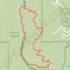
Solstice Canyon Loop
The Solstice Canyon Loop begins near the canyon entrance and climbs onto the sun-exposed Rising Sun Trail, where chaparral, coastal sage scrub, and open hillsides quickly replace the shaded canyon floor, revealing widening views across the folds of the Santa Monica Mountains and toward the Malibu coast.
As the trail arcs above Solstice Canyon, it follows dry slopes and switchbacks before descending toward the greener heart of the drainage, where palms, sycamores, oaks, riparian vegetation, and the sound of year-round water announce the approach to the historic Tropical Terrace / Roberts Ranch ruins, designed by Paul Revere Williams, and the small perennial waterfall tucked just beyond them.
The return follows the gentler Solstice Canyon Trail downstream, passing the old stone Keller hunting cabin, shaded creekside woodland, rocky pools, and canyon walls before easing back toward the trailhead, making the loop a compact Malibu route that blends mountain views, architectural remains, flowing water, and contrasting dry-and-lush canyon landscapes in a natural sequence.
#Hiking #Loop #Canyon #River #Fall #Mountain #Forest #Nature
- Distance: 4.8 Km
- Elevation gain: 245 m
- Maximum elevation: 228 m
- Elevation loss: 245 m
- Minimum elevation: 42 m
Interactive trail map
Trail profile
- Distance: 4.8 Km
- Elevation gain: 245 m
- Maximum elevation: 228 m
- Elevation loss: 245 m
- Minimum elevation: 42 m
About this trail
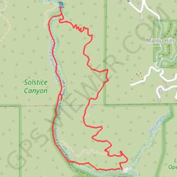
Name: Solstice Canyon Loop trail, distance, elevation, map, profile, GPS track
Start: TRW Loop Trail, Malibu, Los Angeles County, California, 90265, United States (34.03779 -118.74776)
End: TRW Loop Trail, Malibu, Los Angeles County, California, 90265, United States (34.03783 -118.74790)
Coordinates: 34.03773 -118.75438 34.05005 -118.74723
Other hiking, mountain biking, running and outdoor activity trails
Click on a trail to view its statistics, map and profile.